|
HaldermanHome Weather Live Weather Station (1343') - CW7445 Temescal Valley, CA 92883 Located south of Corona in Terramor Community Sunrise: 5:39a |
 Station Info Vantage Pro2 Station By Davis   Tom Harkin's Cams Station Views Summary View Smartphone View Jumps Forecast Almanac Graphs Windy Satellite Radar NOAA Rpts Other Links |
|||||||||||||||
|
||||||||||||||||
|
||||||||||||||||
|
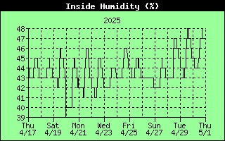
Detailed Station Data:
Today and
Yesterday |
||||||||||||||||
|
Quick Links SD Forecast Discussion NWS Interactive Map Surface Map NWS USA Map Nat. Hur. Center Favorite Pictures HCR Weather Events HCR Weather Extremes Monthly Summary LA/SD/HCR Rainfall Rainfall Research Davis WeatherLink web page |
Links to Stations Near Friends and Family HaldermanHome (CW7445) FindU, MESOWEST, APRS, Forecast Yorba Linda (EW6472) FindU, MESOWEST, APRS, Forecast Medina, OH (FW2245) FindU, MESOWEST, APRS, Forecast Renton, WA (GW0458) FindU, MESOWEST, APRS, Forecast Prescott, AZ (FW4370) FindU, MESOWEST, APRS, Forecast |
Most Accurate Graphical forecast of our area Hourly Graph 10 Day Forecast
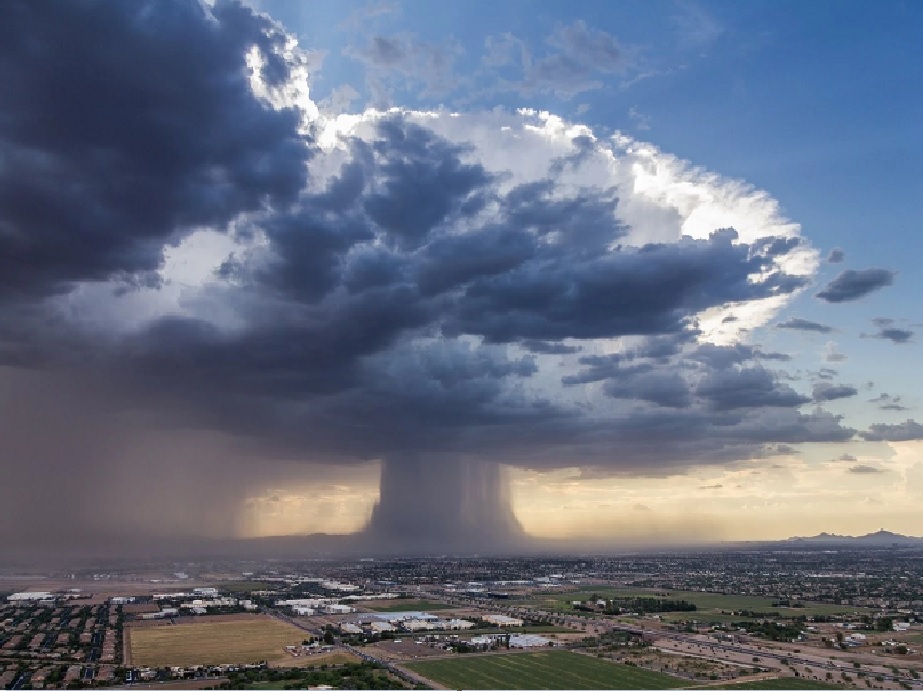
Beautiful Microburst in Pheonix on July 18, 2016
Station Weather Almanac
(National Weather Service and CWOP Station Name
CW7445 )
Records below are from Horsethief Canyon Ranch
across the freeway, about 5 miles away,
until August 2021 - at which time
we moved to the Irontree community in Terramor
|
High Temperature |
Low Temperature |
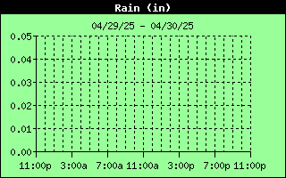
*Rainfall** |
Peak Wind Gust |
|
| Today | °F | °F | 0.00 in | mph |
| Month | °F | °F | 0.00 in | mph |
| Year | °F | °F | 12.52 in | mph |
| 2025 | 106 °F | 37 °F | 35 mph | |
| 2024 | 113 °F | 37 °F | 14.41 in | 35 mph |
| 2023 | 108 °F | 35 °F | 21.45 in | 59 mph |
| 2022 | 113 °F | 36 °F | 8.03 in | 53 mph |
| 2021 | 108 °F | 35 °F | 5.52 in | 53 mph |
| 2020 | 116 °F | 32 °F | 15.49 in | 46 mph |
| 2019 | 106 °F | 32 °F | 20.31 in | 48 mph |
| 2018 | 117 °F | 31 °F | 4.26 in | 35 mph |
| 2017 | 111 °F | 35 °F | 21.52 in | 50 mph |
| 2016 | 115 °F | 33 °F | 6.86 in | 43 mph |
| 2015 | 108 °F | 29 °F | 10.83 in | 38 mph |
| 2014 | 107 °F | 32 °F | 8.47 in | 40 mph |
| 2013 | 106 °F | 30 °F | 5.28 in | 41 mph |
| 2012 | 106 °F | 34 °F | 9.51 in | 42 mph |
| 2011 | 107 °F | 31 °F | 24.17 in | 35 mph |
| 2010 | 108 °F | 31 °F | 17.59 in | 44 mph |
| 2009 | 109 °F | 32 °F | 12.50 in | 43 mph |
| 2008 | 109 °F | 33 °F | 14.70 in | 46 mph |
| 2007 | 108 °F | 25 °F | 2.52 in | 53 mph |
| 2006 | 110 °F | 32 °F | 10.41 in | 43 mph |
| 2005 | 106 °F | 36 °F | 29.73 in | 37 mph |
|
Since 1990 |
117 °F (1) | 25 °F (2) |
35.09 in (3) 2.52 in (4) |
59 mph (5) - NE |
|
Old
Record Keeping Began in 1990 - Ended August 2021, Then Terramor Started |
||||
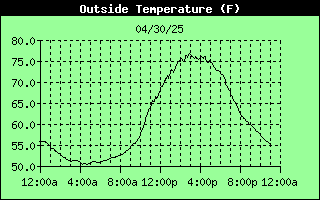
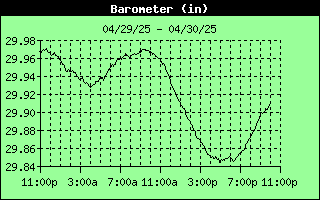
Weather data for the last 24 hours
Last 8 hours,
Last 24 hours,
Last 14 days
|
|
|
|
|
|
|
|
|
|
|
|
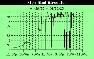 Wind direction for the last 24 hours
Windy Map
Clickable and Expandable Map
Satellite Pictures
GOES Sats
Surface Map
WPC
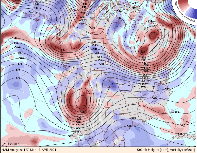
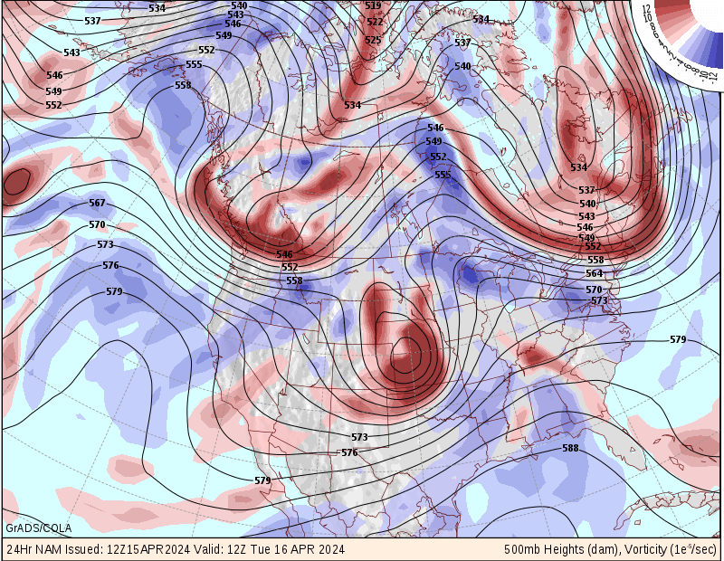
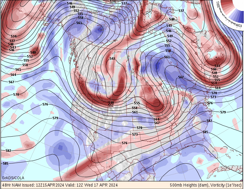
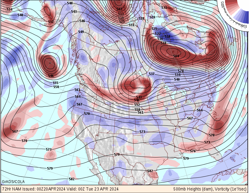
500 mb Charts (
Current,
1 Day, 2 Day,
3 Day,
Anim
)
All Video Models
Here
|
|
Southern California Radar, Santa Ana Radar(El Dorado)
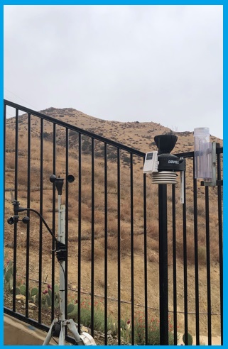
HaldermanHome Station Location (CW7445)
We are feeding data to San Diego's National Weather Service Office. Our station
name at the office is HRRCHL
We are also part of the CWOP Network - which has given us the name
CW7445.
Other views of our data can be found on the internet at
APRS
and
MESOWEST.
NOAA Formatted Text Reports
This Month
Last Month
This Year
Last Year
Historical
Monthly/Yearly Reports
Daily Summary Tables
Last 2 Days
Last 8
Days
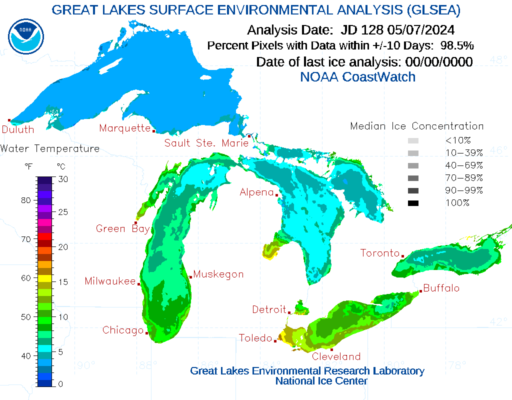
Tom Harkins (HCR Weather Station) SpaceX Launch Live (main page) Precipitation Forecast Map | Current Precip Totals Historical Monthly Precipitation Data another view Historical Presipitation Data (scroll down for links) Lake Elsinore Weather Currents Lake Elsinore Lake Levels California Reservoir Levels CalFire Fire Status Arctic Sea Ice Extent Mt. Washington Live Weather Great Lakes Icing South Pole Weather Death Valley Weather Space Weather ! Link1, Link2 Lightning: Lightning Maps.org Radiation Map
Air Quality in
Temescal Valley
|
Submit Storm Report (here) Submit Rainfall Data Beach Cams Communication Tower Cams
airsites2000 Snow/Mountain Cams |
Page Hits:
Questions/Comments about this site? Contact Tom@HaldHome.com
Web Page Last Updated: 11/15/2023